EarthExplorer
New legacy plugin to drive Google Earth (GE).
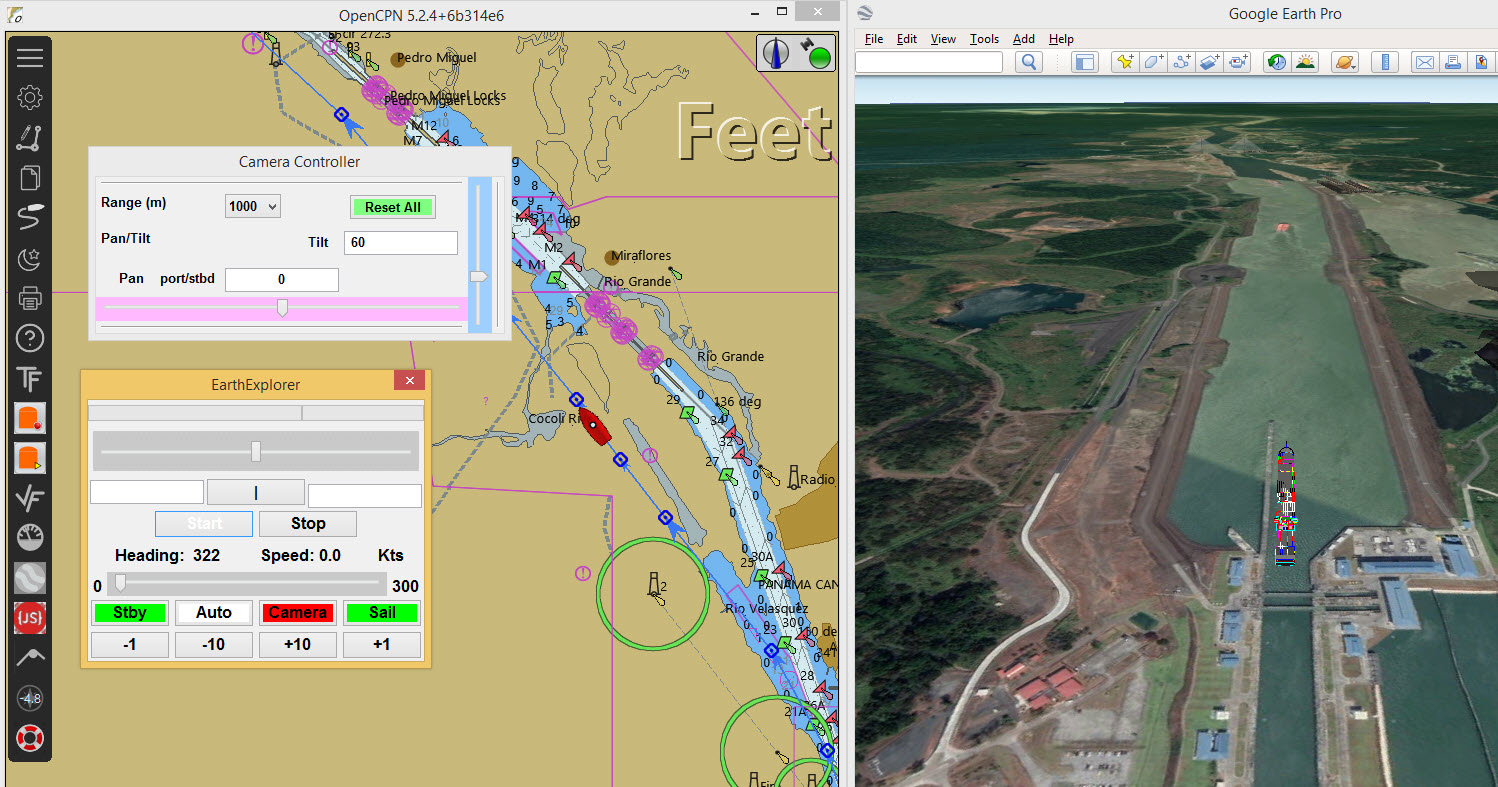
In addition to driving a simulated vessel across the chart of OpenCPN the vessel can be displayed on Google Earth. The plugin controls the GE camera position. The autopilot can be used. A sample GPX is included. This is a route through the new locks at the southern end of the Panama Canal. The default model to drive is a panamax container ship.
Plugin Install
Install the plugin in the normal way for a legacy plugin.
Extra requirements
At the moment the Google Chrome Web Server extension is used to serve the KML files used by GE. Chrome is cross-platform and can be used on MacOSX, Linux and Windows.
-
Install Google Chrome (if not already installed)
-
Start Chrome
-
Add the webserver extension
-
Start the webserver. After this the Chrome Browser can be shut down. It does not have to be the default browser
On first starting to drive with EarthExplorer the files to link with GE are copied to the GetpPrivateApplicationDataLocation() directory. On Windows this will be similar to *C:_pi . On Linux it will be like home/.opencpn/plugins/EarthExplorer_pi/data.
If not already installed download and install Google Earth Pro: https://www.google.com/earth/download/gep/agree.html
Not sure if the version available from Paul Higgins is compatible.
Setting up
Start the Chrome Web Server
It displays with a button to choose the default folder. Select the GetpPrivateApplicationDataLocation() folder mentioned above.
Start OpenCPN
Start your OpenCPN and enable EarthExplorer. Start the plugin to test the drive function is working. Very similar to ShipDriver (!!!). Testing will have created a `placemark.kml' file in the GetpPrivateApplicationDataLocation() folder along with the model file `container.dae'. Another file is also copied there … `link.kml'. This provides the network link with GE.
Start Google Earth
File→Open and select `placemark.kml' from the same folder as you set up in the Chrome webserver. * GE should fly to the location of your vessel. You should see the model in the centre of the GE display. * A place called `model' will have been added to GE `Temporary Places'.
File→Open and select `link.kml'. This will add a place `Earth Explorer' to `Temporary Places'. One of the contents of this place is `model'.
Start driving the vessel in OpenCPN. You should see the model moving across the screen. If you can still see the model that was dropped when you opened `placemark.kml' you can de-select and delete that place, as it is no longer needed.
Select the `3D Buildings' layer in GE if you want to see models. These show the bridges at the southern end of the Panama Canal.
Press `Camera' if you want to zoom in or pan/tilt the display in GE.
Using Options→Ship the `Ship icon type' can be changed to `real scale vector'. A panamax container ship has length 292m, beam 30m. GPS is approx 270m from the bow and midships.